.gif?fit=900%2C676)
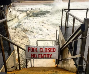
Sydney weather has taken a turn for the worse, bringing torrential rain, storms and flash flooding across the east coast.
Sydney city recorded its coolest April in nine years in terms of minimum temperatures as rain cleared and clouds made way for blue skies, the Bureau of Meteorology [BOM] said in its monthly report.
However May was unseasonably warm which left Sydneysiders wondering if the sunshine and high-teen temperatures would continue into winter.
Sadly they did not.
May’s temperatures dipped significantly at the end of the month with Observatory Hill recording a minimum temperature of 7.1 degrees on the 30th, the coldest May night since 16 May 1999 (where it dipped to 6.6 degrees).
This cooler weather continued into autumn, and left Sydney’s residents shivering as June started with a cold snap.
But will it ever stop raining?
Yes, but not just yet.
After a wet start to autumn (Sydney experienced its wettest March since 1975) and a dry April and May, June has picked up the drenching and delivered 100 millimetres of rain to parts of Sydney in the 24 hours since 9am yesterday(June 7, 2017). Another 20-30mm is expected to hit the city today.
And as for the Queen’s Birthday long weekend? The weather forecast for Sydney is not looking good.
Friday is expected to get a 25mm drenching, with 20mm on Saturday, 25mm on Sunday, and 10-20mm on Monday.
The radar from BOM is ominous, and yesterday showed the east coast low dominating the NSW coast, and is the reason why Sydney was getting absolutely soaked.
Stay dry, Sydney.