
When the really cold weather sets in, sometimes all you want to do pack up and head to where you can thaw out. Somewhere not too hot, but not too cold… juuuust right. But where’s that exactly?
Aside from furiously Googling “when’s the best time to visit… ” for all of your bucket list destinations and compiling all the answers on a spreadsheet, there’s really no easy way to find this out.
Until now.
Enter Ryan Whitaker, a weather-obsessed data guru who’s done all the hard work for you, creating an interactive weather map that tracks temperatures on any given week – including weeks in the far, far future. For this it uses 10 years of weather data gathered from more than 10,000 weather stations around the globe.
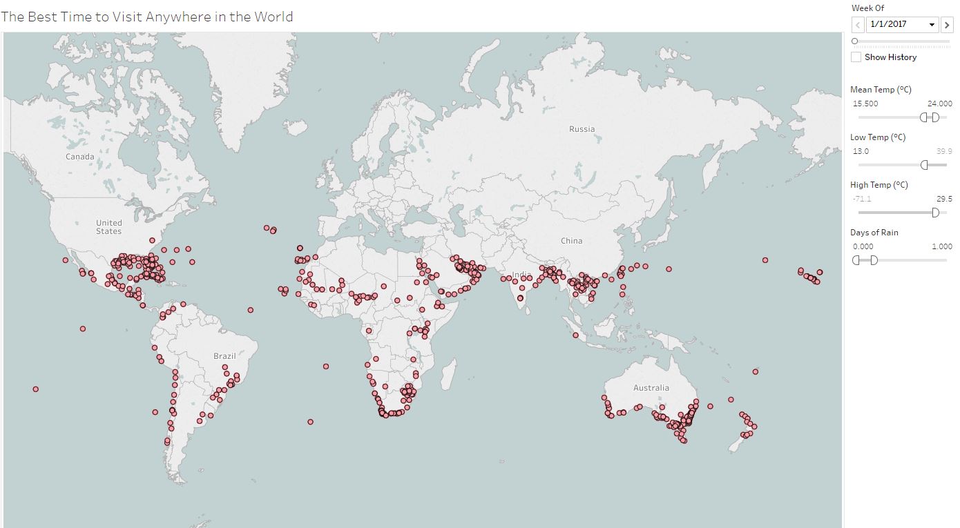
^ Sorry, just an image. Not the interactive version.
So how does it work? Well, you simply select the week you want to travel, your ideal mean, low and high temperatures as well as ideal rainfall then click the magic button and pink dots will appear for the locations that suit your preferences.
However, before you pack your bikini and sunscreen, Ryan issues a couple of disclaimers about his genius creation. 1) Rain and snowfall is not 100 per cent accurate due to some weather stations not monitoring this year-round, making data unreliable. 2) It does not factor in humidity so while you’ll get that perfect 35 degrees you’re after, it will come with a side of frizzy hair.
Happy travels.